SE "Srbijašume", FA "Avala", Avalska 79, 11223 Beli potok
011/390-6626, 011/390-6619
Work hour: 07-15
www.srbijasume.rs
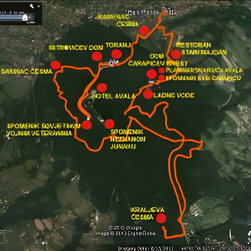
Avala is the northernmost mountain of the Šumadija range, which stretches from the Sava and the Danube to the Rudnik mountain. It is located at an altitude of 200 to 506 meters above sea level, and it is precisely those 6 meters over 500m that deserve to be called a mountain.
Avala owes its name to the Turkish name for the former medieval fortress on its top, which was originally called Havala, and later Žrnov. Unfortunately, it was demolished in order to build today's monument to the Unknown Hero in its place. The area of Avala is about 500ha. It is covered by coppice, we can say natural, deciduous forests and conifer cultures, and in addition to natural values, there are also numerous cultural and historical monuments. About 600 plant species can be found on it. All this was the reason that in 2007, by decision of the city of Belgrade, Avala was declared a protected natural area entrusted to JP "Srbijašume", i.e. ŠU "Avala" for management. Otherwise, what is characteristic of all Belgrade's forests is that during the 1st and 2nd World War they suffered heavy logging, and after that the forest largely regenerated itself from the stumps, hence the term coppice forest. On Avala, the most common types of trees are oaks, namely sallow, cherry and sedum. Other types of trees include hornbeam, black and white ash, as well as beech, which forms a single stand on the northern slope of Avala, which is under a special protection regime. Of the artificially raised crops, black and white pine crops over 100 years old and somewhat younger Douglas fir crops are represented.
 |
 |
 |
 |
